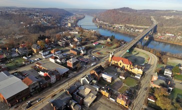
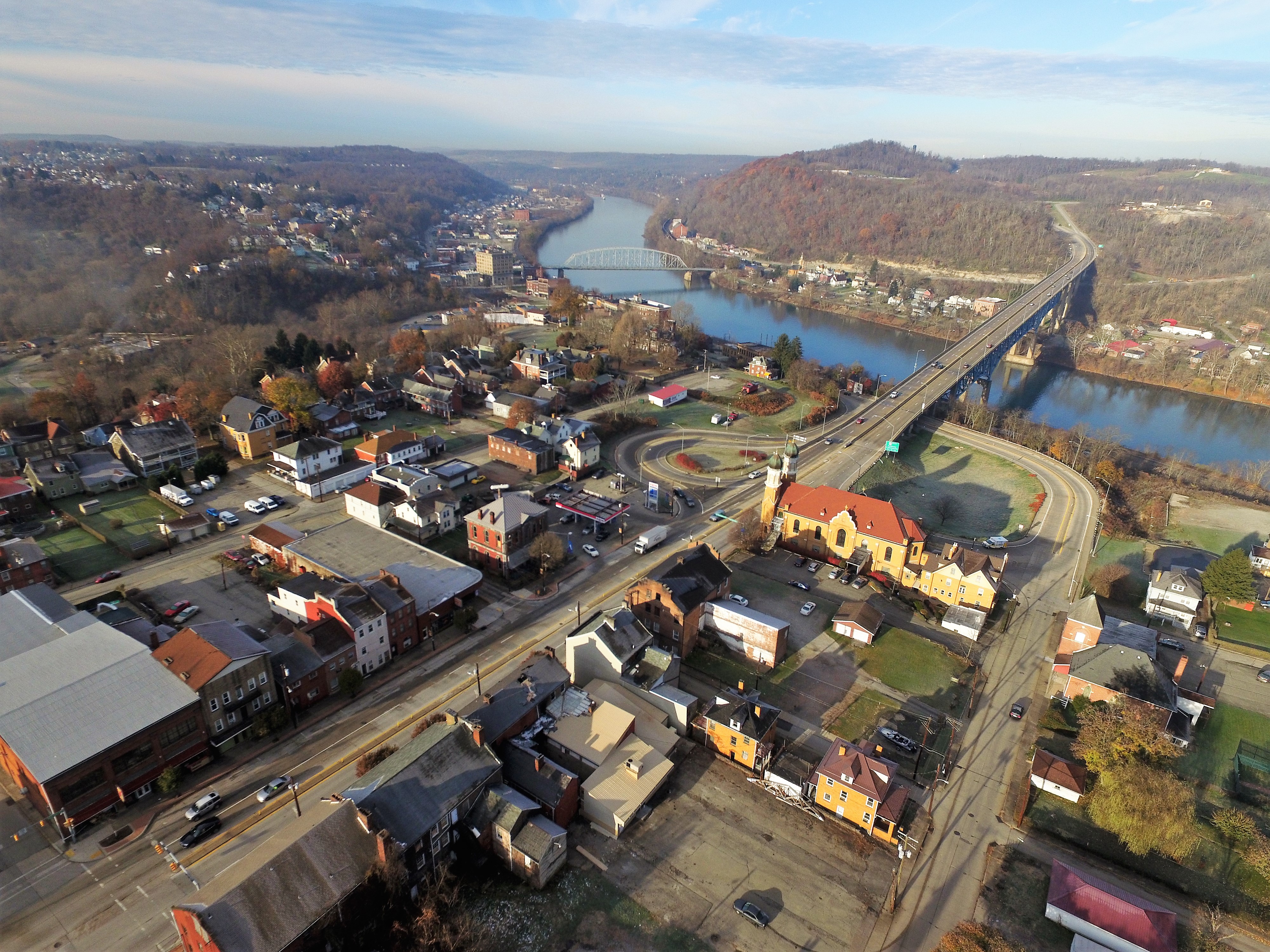
Brownsville is a borough in Fayette County, Pennsylvania, United States, first settled in 1785 as the site of a trading post a few years after the pacification of the Iroquois enabled a post-Revolutionary war resumption of westward migration. The Trading Post soon became a tavern and Inn, and was soon receiving emigrants heading west as it was located above the cut bank overlooking first ford that could be reached to those descending from the Mountains Brownsville is located 40 miles (64 km) south of Pittsburgh along the east bank of the Monongahela River.
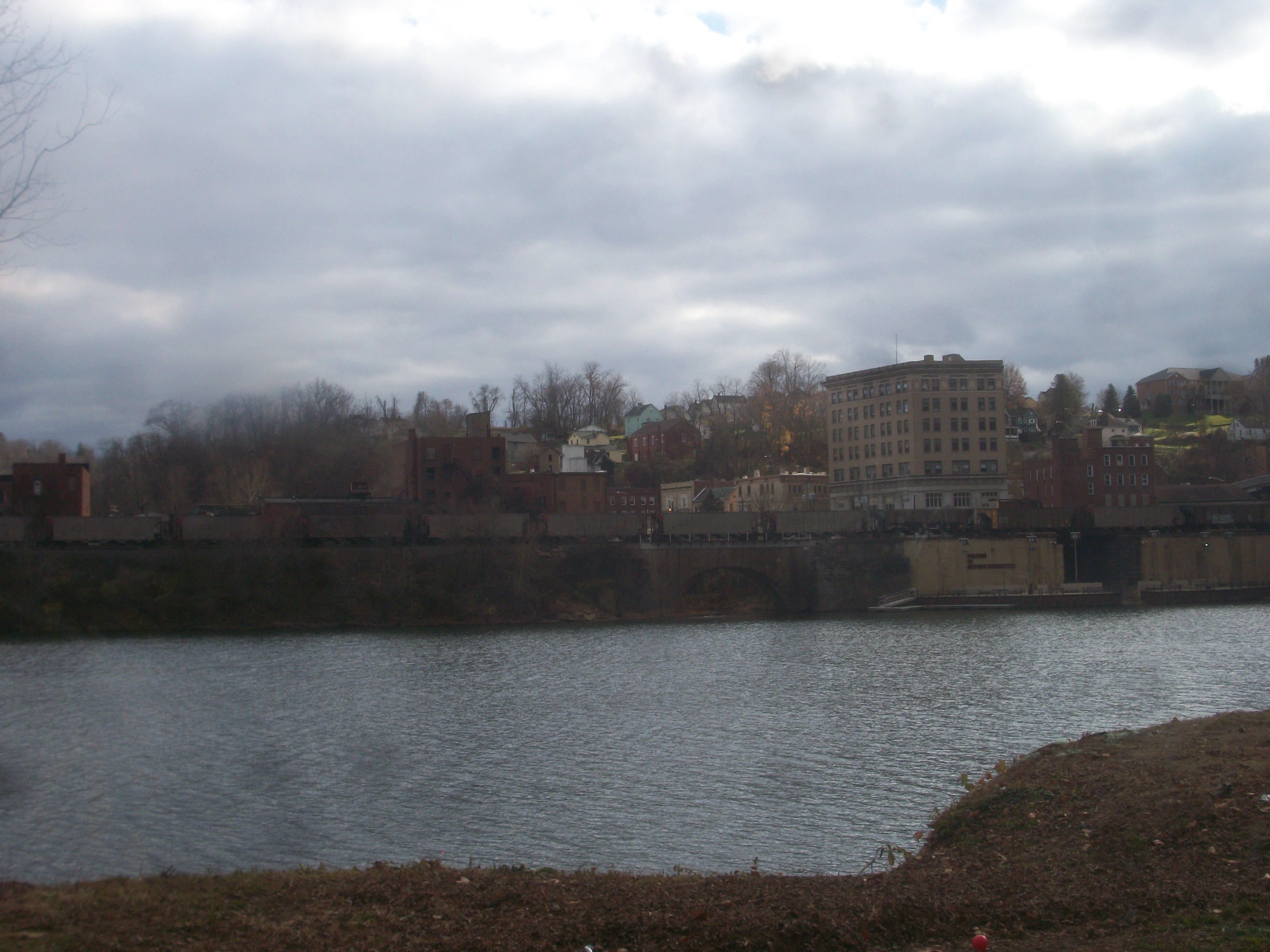
According to the United States Census Bureau, the borough of Brownsville, located as a county border town has a total area of 1.1 square miles (2.8 km2), of which 0.97 square miles (2.5 km2) is land and 0.1 square miles (0.3 km2), or 10.47%, is water—most of which is the Fayette County half of the Monongahela River between the community and the flatter lands of opposite shore West Brownsville in Washington County. As a community, the town is the central population center for a number of outlying hamlets geographically tied to the town for the same reasons they were founded nearby—Western Pennsylvania has far more hills and steep slopes than flats or gentle sloping terrains suitable for settlement. This keeps Brownsville at the nexus of the transportation infrastructure which grew up during its history. While no longer a passenger depot, the town and cross-River West Brownsville share an important Railway bridge creating a balloon loop allowing the turning of complete coal trains. Newest is the limited access toll road PA Route 43, which connects the town to strategic points and southern Pittsburgh at Clairton. River hugging PA Route 88, connects to towns up and down the Mon Valley and the historic National Road (now US Route 40) reached East Saint Louis, Illinois and connected the town to the immigrants arriving in the port of Baltimore traveling west on the Cumberland Turnpike and the National Road.
From its founding, well into the 19th century, as the first reachable population center west of the Alleghenies barrier range on the Mississippi watershed, the borough quickly grew into an industrial center, market town, transportation hub, outfitting center, and river boat-building powerhouse. It was a gateway destination for emigrants heading west to the Ohio Country when a trading post, and the new United States' Northwest Territory and their "legal successors" for travelers heading westwards on the various Emigrant Trails both to the Near West and later Far West from its founding until well into the 1850s. As outfitting center, the borough provided the markets for the small-scale industries in the surrounding counties—and also, quite a few in Maryland shipping goods over the pass by mule-train via the Cumberland Narrows toll-route.
Brownsville became a major center for building steamboats through the 19th century, producing 3,000 boats by 1888.
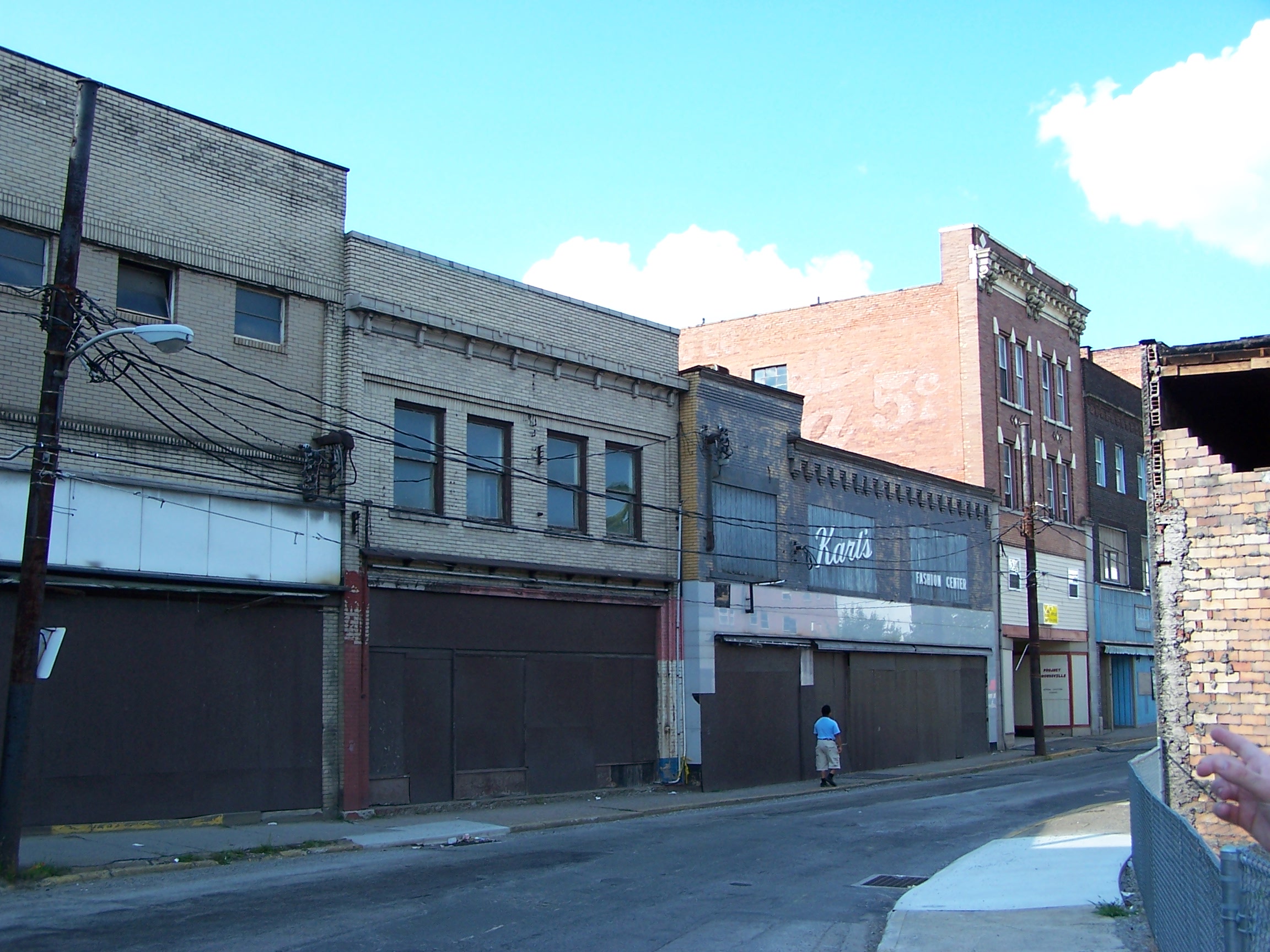
The borough developed in the late 19th century as a railroad yard and coking center, with other industries related to the rise of steel in the Pittsburgh area. It reached a peak of population of more than 8,000 in 1940. Postwar development occurred in suburbs, as was typical of the time. The restructuring of the railroad and steel industries caused a severe loss of jobs and population in Brownsville, beginning in the 1970s. The borough had a population of 2,331 as of the 2010 census.
Write a Review About Brownsville For A Chance to Win A $100 Amazon Gift Card

Popular Articles View all
 LIVING
Is It OK To Say "OK, Boomer?"
It sounds like a cheeky way to blow off the opinion of someone older than you—but does this phrase cross the line when it comes to snark?
 LIVING
Research Reveals 1 out of 3 Retirees Would Live Elsewhere
A surprisingly high percentage of retirees say they’d pick a different spot in which to spend their later years. In a survey of people in their 70’s, 31% say “no” when asked “if you had to do it all over again, based on what you know now, would you choose where you are currently residing again?”.
 LIVING
Looking to Stay Young at 80? Learn from Two Nude Models
Barry and Joanne have been married 57 years. They've spent the last 15 modeling.
 LIVING
Rock and Roll Never Gets Old
Rock and Roll never gets old—and you can tell because of the upcoming concert season. Some of the hottest tickets of the summer, purchased by concertgoers of all ages, are for performers that are age 60 plus!
 LIVING
1 in 4 Americans Say They'll Never Retire
Recent poll results show that 1 in 4 Americans plan on never retiring. Some view it optimistically as older adults finding purpose in work, others as a growing sign of desperation among older workers. Where does the truth lie?
 LIVING
"The Best is Yet to Come" Movie Awards
Which movie treats older adults with the most respect - breaking from stereotypes through multi-dimensional characters who make interesting and complicated choices about how to live their best lives?
 LIVING
Is Your Town or Employer Age Friendly?
Age Friendly Advisor focuses on where we live and work in our later years - and how we engage with our communities. Go to your town's page and post your review. What makes it age friendly - or not? Go to the 'Working' section and post an employer review. What makes your employer age friendly - or not?
 LIVING
Ageism Today
Even as ageism affects millions of people around the world, it remains a challenge to both identify and combat it. Take our survey to weigh in.
 LIVING
Crowd-sourcing Set To Accelerate Age Friendly Movement
“We need engagement from the bottom in addition to action from the top,” the World Health Organization’s Dr. John Beard tells Age Friendly Advisor.
